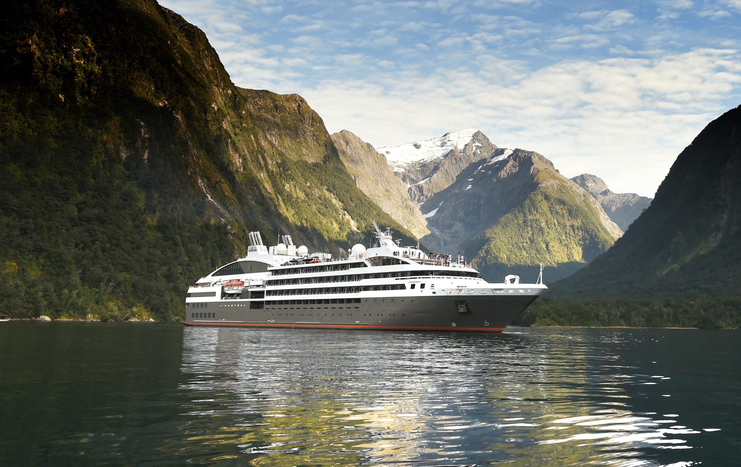
Itinerary
Nuuk, meaning “the cape”, was Greenland’s first town (1728). Started as a fort and later mission and trading post some 240 kilometers south of the Arctic Circle, it is the current capital. Almost 30% of Greenland’s population lives in the town. Not only does Nuuk have great natural beauty in its vicinity, but there are Inuit ruins, Hans Egede’s home, the parliament, and the Church of our Saviour as well. The Greenlandic National Museum has an outstanding collection of Greenlandic traditional dresses, as well as the famous Qilakitsoq mummies. The Katuaq Cultural Center’s building was inspired by the undulating Northern Lights and can house 10% of Nuuk’s inhabitants.
Located in northern Baffin Island, Pond Inlet is a small, predo¬minantly Inuit community, with a population of roughly 1,500 inhabitants. In 1818, the British explorer John Ross named a bay in the vicinity after the English astronomer John Pond. Today Pond Inlet is considered one of Canada’s “jewels of the North” thanks to several picturesque glaciers and mountain ranges nearby. Many archaeological sites of ancient Dorset and Thule peoples can be found near Pond Inlet. The Inuit hunted caribou, ringed and harp seals, fish, polar bears, walrus, narwhals, geese, ptarmigans and Arctic hares, long before European and American whalers came here to harvest bowhead whales. Pond Inlet is also known as a major center of Inuit art, especially the printmaking and stone carving that are featured in the town’s art galleries.
Devon Island is Canada’s sixth largest island and was first seen by Europeans in the early 17th century. The Thule culture had already settled there many centuries before, and left behind qarmat homes, made of rocks, whale bones, rock and sod walls, and skins for roofs that tell a story of over 800 years of human habitation. Other striking finds in this area are the many fossils of corals, crinoids and nautiloids that can be seen. Just across Lancaster Sound is Prince Leopold Island, a Canadian Important Bird Area, a federally listed migratory bird sanctuary, and a Key Migratory Bird Terrestrial Habitat site with large numbers of Thick-billed Murres, Northern Fulmars and Black-legged Kittiwakes that breed there.
Devon Island is Canada’s sixth largest island and was first seen by Europeans in the early 17th century. The Thule culture had already settled there many centuries before, and left behind qarmat homes, made of rocks, whale bones, rock and sod walls, and skins for roofs that tell a story of over 800 years of human habitation. Other striking finds in this area are the many fossils of corals, crinoids and nautiloids that can be seen. Just across Lancaster Sound is Prince Leopold Island, a Canadian Important Bird Area, a federally listed migratory bird sanctuary, and a Key Migratory Bird Terrestrial Habitat site with large numbers of Thick-billed Murres, Northern Fulmars and Black-legged Kittiwakes that breed there.
Beechey Island is a small island off the southwest coast of Devon Island, separated by a narrow waterway called the Barrow Strait. Captain William Edward Parry was the first European to visit the island in 1819. His lieutenant, Frederick William Beechey, named the island after his father, the artist William Beechey (1753–1839). Beechey Island played a significant role in the history of Arctic Exploration. During the winter of 1845-46, Sir John Franklin and his men camped on the island as part of their ill-fated quest to find the Northwest Passage. Mummified remains of three of Franklin’s crew were discovered, giving a better understanding of what happened before the disappearance of the expedition. In 1850 Edward Belcher used the island as a base while surveying the area. Later, in 1903, Norwegian explorer Roald Amundsen stopped at the island at the beginning of his successful voyage in search for the Northwest Passage. Subsequently, Beechey Island has been declared a “Territorial Historic Site” since 1975 by the Northwest Territories government
Devon Island is Canada’s sixth largest island and was first seen by Europeans in the early 17th century. The Thule culture had already settled there many centuries before, and left behind qarmat homes, made of rocks, whale bones, rock and sod walls, and skins for roofs that tell a story of over 800 years of human habitation. Other striking finds in this area are the many fossils of corals, crinoids and nautiloids that can be seen. Just across Lancaster Sound is Prince Leopold Island, a Canadian Important Bird Area, a federally listed migratory bird sanctuary, and a Key Migratory Bird Terrestrial Habitat site with large numbers of Thick-billed Murres, Northern Fulmars and Black-legged Kittiwakes that breed there.
Nuuk, meaning “the cape”, was Greenland’s first town (1728). Started as a fort and later mission and trading post some 240 kilometers south of the Arctic Circle, it is the current capital. Almost 30% of Greenland’s population lives in the town. Not only does Nuuk have great natural beauty in its vicinity, but there are Inuit ruins, Hans Egede’s home, the parliament, and the Church of our Saviour as well. The Greenlandic National Museum has an outstanding collection of Greenlandic traditional dresses, as well as the famous Qilakitsoq mummies. The Katuaq Cultural Center’s building was inspired by the undulating Northern Lights and can house 10% of Nuuk’s inhabitants.
Ship features
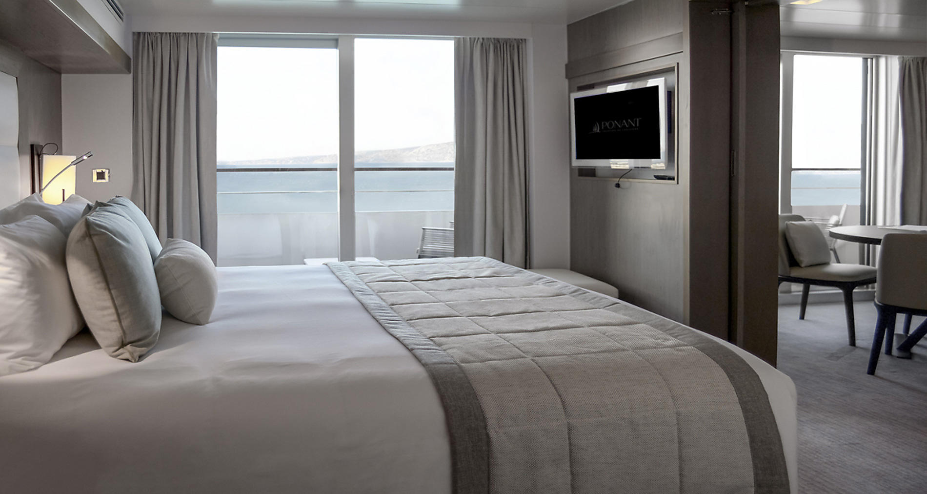
Owner's Suite
Services provided
- 24h room service
- Inclusive Internet access Wi-Fi (availability dependent on navigation and latitude)
- Individually-controlled air conditioning
- Dressing room with shelves and closet
- Dressing table and hairdryer
- Hermès top-of-the-line bath products
- Minibar included
- Nespresso coffee maker and boiler
- Electronic safe
- Direct line telephone
- Bose Bluetooth speaker
- Flat screen TV, international channels (availability dependent on navigation) and videos on demand
- 110V American (two flat pins)/220V European (round sockets with two round pins)
- Three ADA staterooms
In addition to the common services provided to all our suites and staterooms:
- Private return transfer
- Priority boarding
- Champagne and fruit basket upon arrival
- Butler service
- An assortment of sweet or savoury canapés and a basket of fruit every day
- A bedroom with one king-size bed (180 x 200 cm) or two single beds (90 x 200 cm) and TV
- A living/dining room with a sofa, an armchair, a TV, a 4-seater table and sliding courtesy door
- A bathroom with shower and balneo bathtub
- A one-hour spa care for one person in the well-being space, chosen from the facial and body treatments on offer
- A private 9 m² balcony
- Two panoramic sliding bay windows
Deluxe Suite
Services provided
- 24h room service
- Inclusive Internet access Wi-Fi (availability dependent on navigation and latitude)
- Individually-controlled air conditioning
- Dressing room with shelves and closet
- Dressing table and hairdryer
- Hermès top-of-the-line bath products
- Minibar included
- Nespresso coffee maker and boiler
- Electronic safe
- Direct line telephone
- Bose Bluetooth speaker
- Flat screen TV, international channels (availability dependent on navigation) and videos on demand
- 110V American (two flat pins)/220V European (round sockets with two round pins)
- Three ADA staterooms
In addition to the common services provided to all our suites and staterooms:
- Priority boarding (depending on port of embarkation)
- Champagne and fruit basket upon arrival
- Butler service
- A fruit basket every day
- One king-size bed (180 x 200 cm) or two single beds (90 x 200 cm) and TV
- An armchair and a sofa (167 x 70 cm)
- A bathroom with shower
- A private 5 m² balcony
- A panoramic sliding bay window
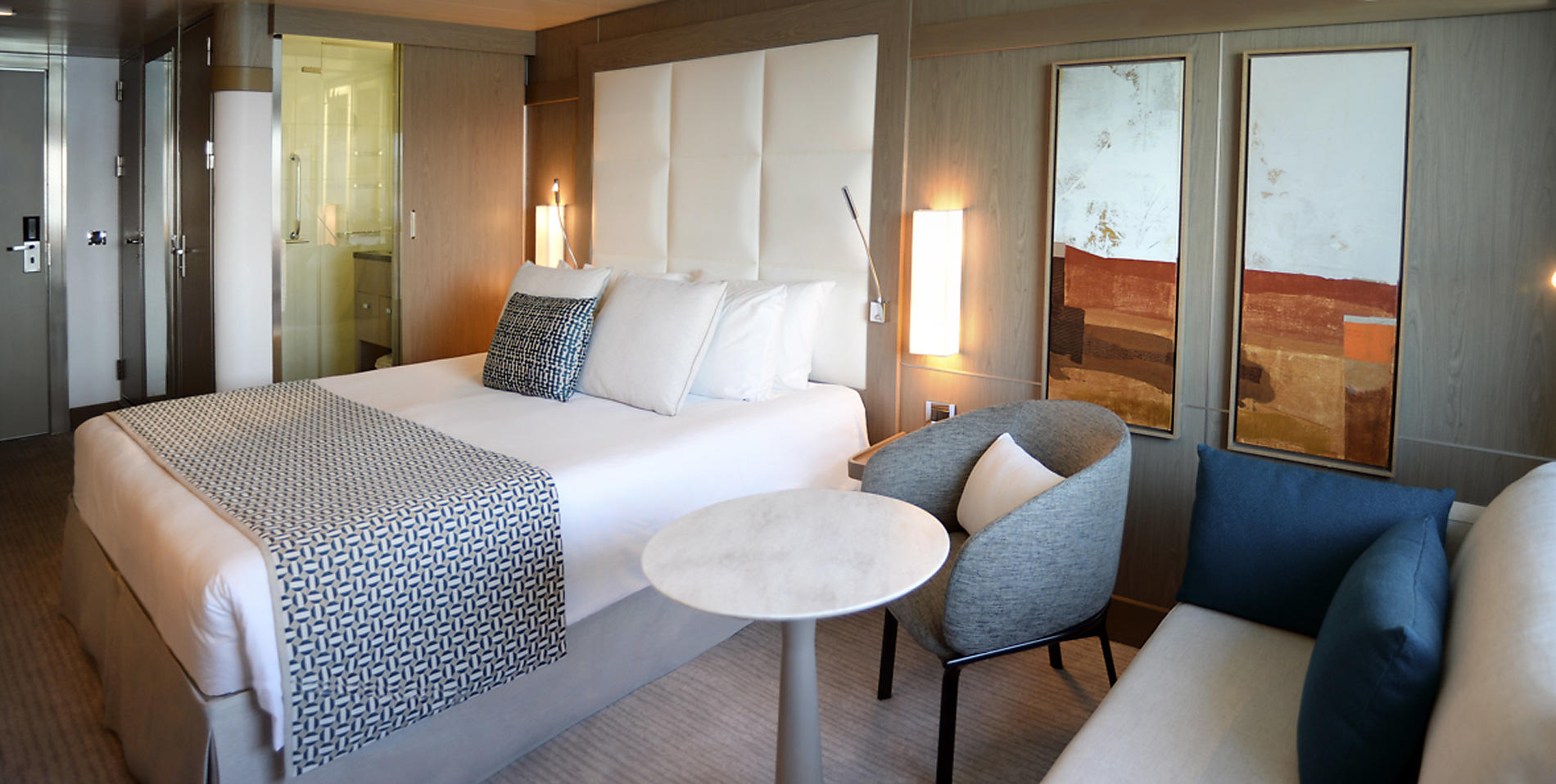
Prestige Suite
Services provided
- 24h room service
- Inclusive Internet access Wi-Fi (availability dependent on navigation and latitude)
- Individually-controlled air conditioning
- Dressing room with shelves and closet
- Dressing table and hairdryer
- Hermès top-of-the-line bath products
- Minibar included
- Nespresso coffee maker and boiler
- Electronic safe
- Direct line telephone
- Bose Bluetooth speaker
- Flat screen TV, international channels (availability dependent on navigation) and videos on demand
- 110V American (two flat pins)/220V European (round sockets with two round pins)
- Three ADA staterooms
In addition to the common services provided to all our suites and staterooms:
- Champagne and fruit basket upon arrival
- An assortment of sweet or savoury canapés and a basket of fruit every day
- A bedroom with king-size bed (180 x 200 cm) or two single beds (90 x 200 cm) and TV
- A lounge with a sofa convertible to a king-size bed (180 x 200 cm) or two single beds (90 x 200 cm), armchairs, a TV and a sliding courtesy door
- Two bathrooms with shower
- A private 8 m² balcony
- Two panoramic sliding bay windows
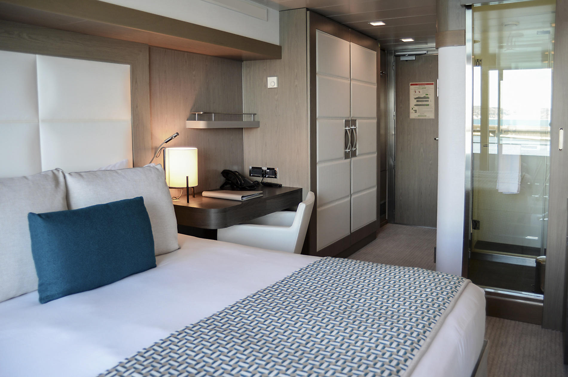
Superior Stateroom
Services provided
- 24h room service
- Inclusive Internet access Wi-Fi (availability dependent on navigation and latitude)
- Individually-controlled air conditioning
- Dressing room with shelves and closet
- Dressing table and hairdryer
- Hermès top-of-the-line bath products
- Minibar included
- Nespresso coffee maker and boiler
- Electronic safe
- Direct line telephone
- Bose Bluetooth speaker
- Flat screen TV, international channels (availability dependent on navigation) and videos on demand
- 110V American (two flat pins)/220V European (round sockets with two round pins)
- Three ADA staterooms
In addition to the common services provided to all our suites and staterooms:
- One king-size bed or two single beds (180 x 200 cm) and TV
- A bathroom with shower
- A window (except for stateroom 300: a round porthole only)
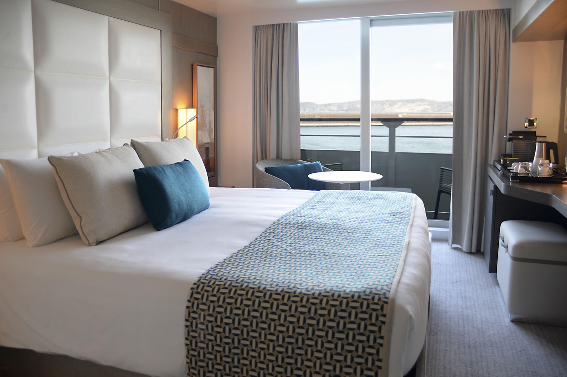
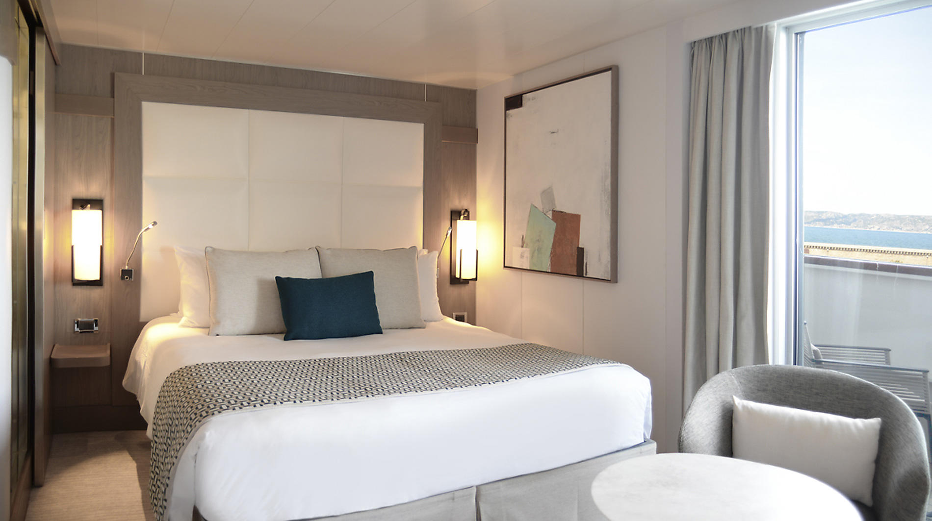
Prestige Stateroom
Services provided
- 24h room service
- Inclusive Internet access Wi-Fi (availability dependent on navigation and latitude)
- Individually-controlled air conditioning
- Dressing room with shelves and closet
- Dressing table and hairdryer
- Hermès top-of-the-line bath products
- Minibar included
- Nespresso coffee maker and boiler
- Electronic safe
- Direct line telephone
- Bose Bluetooth speaker
- Flat screen TV, international channels (availability dependent on navigation) and videos on demand
- 110V American (two flat pins)/220V European (round sockets with two round pins)
- Three ADA staterooms
In addition to the common services provided to all our suites and staterooms:
- One king-size bed (180 x 200 cm) or two single beds (90 x 200 cm) and TV
- A bathroom with shower
- A private 4 m² balcony
- A panoramic sliding bay window
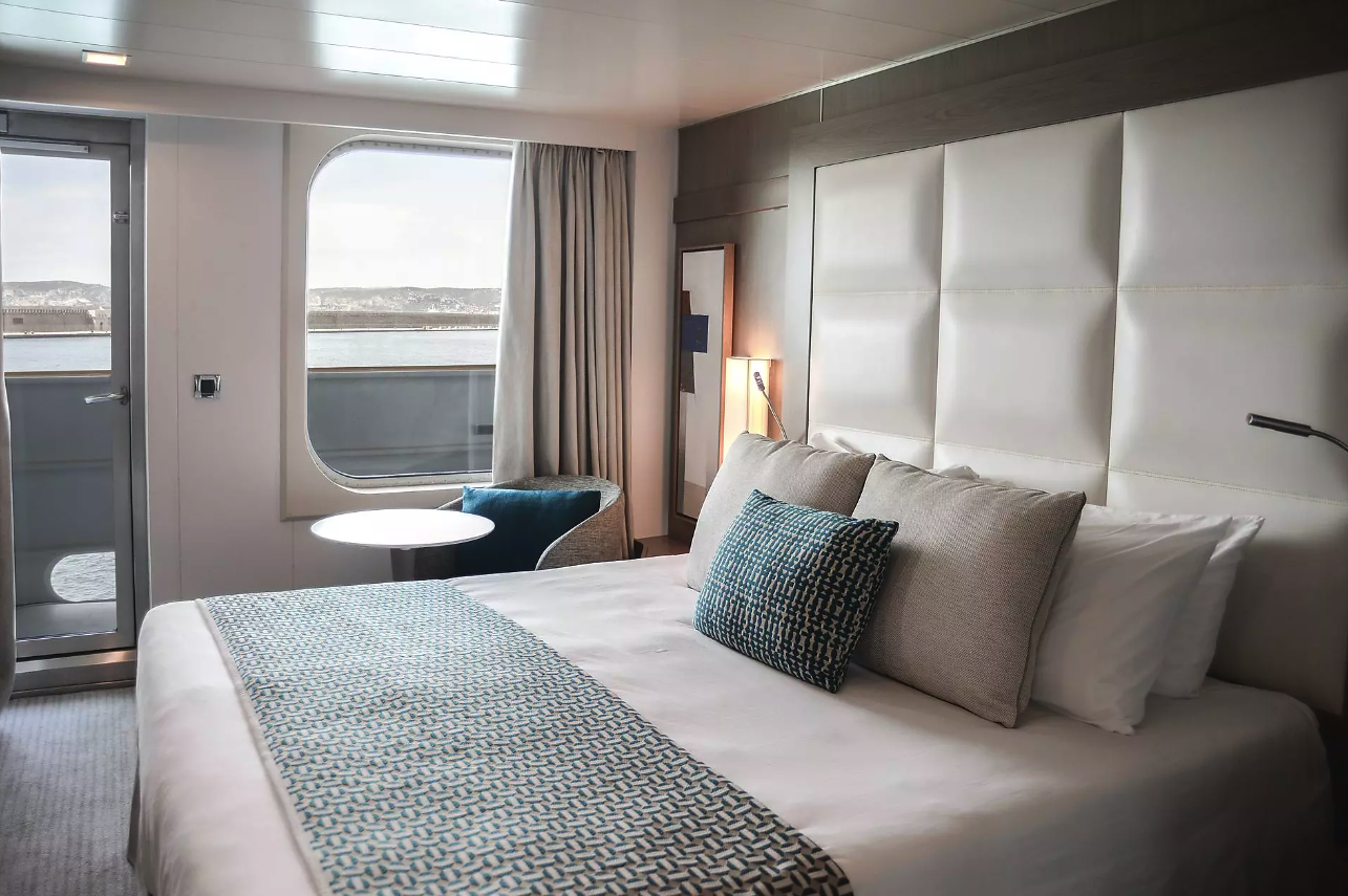
Deluxe Stateroom
Services provided
- 24h room service
- Inclusive Internet access Wi-Fi (availability dependent on navigation and latitude)
- Individually-controlled air conditioning
- Dressing room with shelves and closet
- Dressing table and hairdryer
- Hermès top-of-the-line bath products
- Minibar included
- Nespresso coffee maker and boiler
- Electronic safe
- Direct line telephone
- Bose Bluetooth speaker
- Flat screen TV, international channels (availability dependent on navigation) and videos on demand
- 110V American (two flat pins)/220V European (round sockets with two round pins)
- Three ADA staterooms
In addition to the common services provided to all our suites and staterooms:
- One king-size bed (180 x 200 cm) or two single beds (90 x 200 cm) and TV
- A bathroom with shower
- A private 4 m² balcony
- A window and a panoramic glazed swing door

Le Coromandel
A la carte meals are served at the table in the gastro restaurant. At lunch, a selection of dishes inspired by contemporary French brasseries will be offered. At dinner, it is time to sample the grand traditions of French fine dining, with menus to go with one of the best wines from our cellar, as recommended by our sommelier.
To the rear of deck 2 you’ll find a gastronomic restaurant big enough to seat all passengers together at one sitting.
- 3,980 square feet
- Capacity: 268
- Breakfasts, lunches and dinners, French and international cuisine, elegance and refinement
- Wine cellar

Le Rodrigues
Enjoy breakfasts, buffet lunches and themed dinners in a relaxed atmosphere at the grill restaurant on Deck 6.
- 2,530 square feet
- Interior capacity: 150
- Exterior capacity: 60
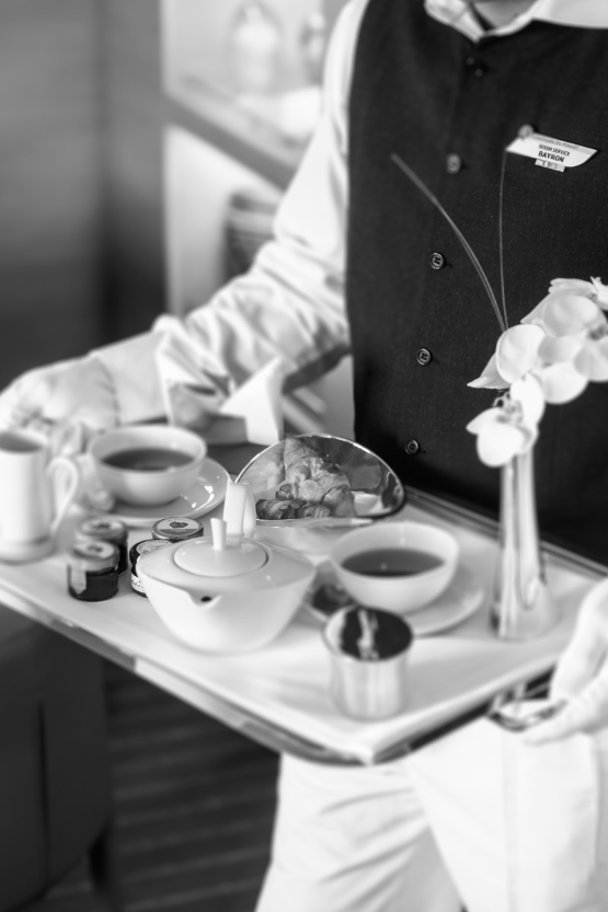
Room Service
Whether you wish to have breakfast in the privacy of your stateroom, savour a snack in the middle of the day or enjoy your dinner in an intimate setting, our Room Service is available for you. Have a gourmet interlude and treat yourself from a varied menu at any time of day or night.

Excursions
Excursions & land itineraries
Each itinerary has been thoughtfully created by our teams to offer you a complete excursion experience. You can discover the hidden gems of the regions you visit in line with your interests.
Hidden creeks, ancient cities, UNESCO world heritage sites… the world reveals its hidden gems as you journey along the routes taken by travellers. In keeping with our ethos “Accessing the worlds treasures by sea”, we offer a wide choice of land excursions during all our cruises (except for expeditions). Chosen by our PONANT experts for their cultural value and historic interest, these excursions can last a few hours or a few days. If you need to stay on land overnight, we take care of your stay from start to finish, until you rejoin your ship. These longer excursions mean you can discover the unmissable sites of the region you are visiting, like Cuzco in Peru for example or the Mekong Delta in Vietnam.
You can access these trips by pre-booking two months before your departure date.

Panoramic Lounge
The cosy piano bar is a panorama lounge with breathtaking views of the horizon.
- Deck 6
- 1,185 square feet
- Library, internet space, bar, live entertainment on certain evenings
- Direct access to the panoramic terrace

Exterior Bar
The outside bar is a great space for relaxing and is handy for accessing the swimming pool* and its solarium.
- Deck 6
- Lounge area with seating for 50
- Overlooking the pool deck
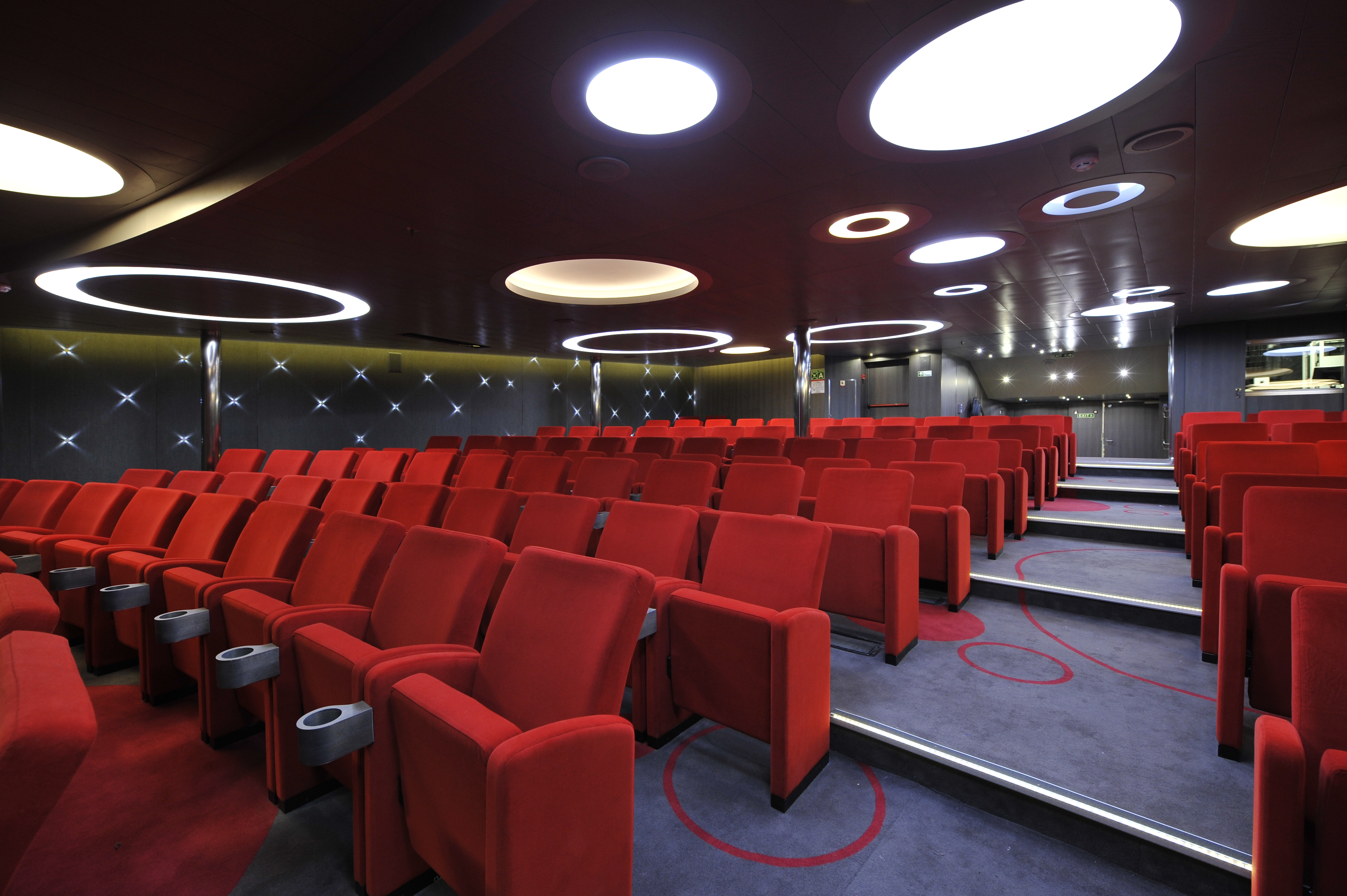
Theatre
The Theatre* is the most unique meeting space on board. It’s the largest space on the ship and regularly accommodates all the passengers. It plays host to shows and entertainment as well as conferences from our experts, naturalist guides and guests of honours. The Theatre makes every cruise unique and enriching thanks to its constant and very accessible events.
Settle comfortably into your seat and enjoy a range of different shows, concerts and performances organised by the professional dancers and musicians onboard.
Special musical evenings, dance evenings and culture and music quizzes are held. Additionally, traditional local music concerts, featuring styles such as Corsican polyphony and Caribbean steel band music, are performed out on deck in the open air by bands specially invited onboard for the purpose.
- Deck 4
- 2,690 square feet
- Capacity: 250
- Conference room, concert hall/multi-purpose auditorium
- Audiovisual equipment
On-board events
There are performers on board all of our ships. Recruited for their talent in Paris and Rome, they star in multiple shows at the Theatre, after dinner. Throughout your voyage, they host the various entertainment events in the Grand Salon, with the support of our on-board musicians.
During Tea Time or before dinner, our musical duos consisting of a singer and an accompanying musician play classical repertoires for you. In the evening, they play in concert at the Theatere or invite you to show off your dance moves. Dance evenings are thus co-led by performance dancers who know just how to keep you in step, under the direction of the Cruise Director.
There’s plenty of themed entertainment to enjoy in the evenings. Both a soirée blanche (dress-in-white party) and an officers’ evening are held on all long cruises. Other types of parties or evening events may also be on the programme, such as karaoke parties, a Casino parties or games evenings.
Films are regularly shown at the Theatre on giant screens. National Geographic features, documentaries related to our expedition route and feature films contribute to the cultural enrichment that is part of our cruise philosophy.
The Sun Deck
The outdoor areas on our ships, comfortable and conducive to relaxation, have been designed to merge into the sublime scenery and surroundings of the sea and horizon. There is a heated seawater pool featuring its own sun lounge on the top deck of our sister ships (Le Boréal, L’Austral, Le Soléal and Le Lyrial) and on the third deck of the PONANT EXPLORERS (Le Lapérouse, Le Champlain, Le Bougainville, Le Dumont-D’Urville, Le Jacques Cartier and Le Bellot). Le Ponant is equipped with a 400 m² (4,300 ft²) sun deck.
Leisure Area
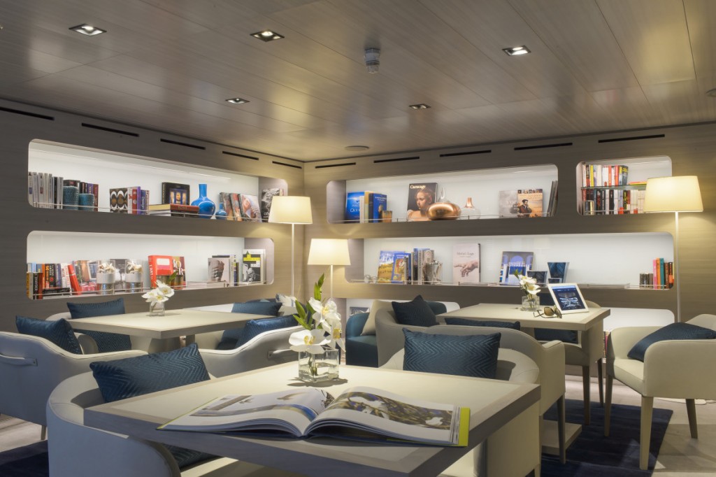
Dedicated to leisure and relaxation, the libraries onboard all our ships stock a range of books and board games. This space is also equipped with Wi-Fi connected computers.
The Sisterships and The PONANT Explorers have a special area for children onboard known as the Kids Club. Books, television, board games and consoles (PS4 or Wii™) are all provided for their use and enjoyment.

The Main Lounge
The main lounge is the ideal place to relax with a drink and enjoy the various activities that have been organised such as dancing classes or theme evenings.
- Deck 3
- 2,740 square feet
- Interior capacity: 110
- Exterior capacity: 30
- Tea rooms, bar, programme of live musical entertainment, dance floor
- Access to the exterior terrace
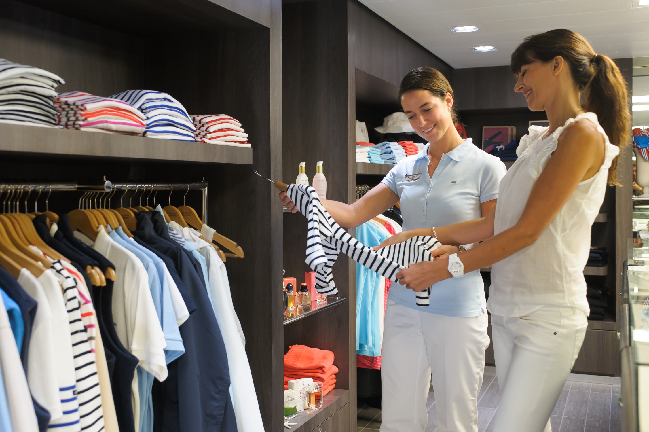
Shop
On board all our ships, a shop is open during sailing. It offers a selection of presents and souvenirs: clothing, jewellery, beauty products, postcards and accessories.
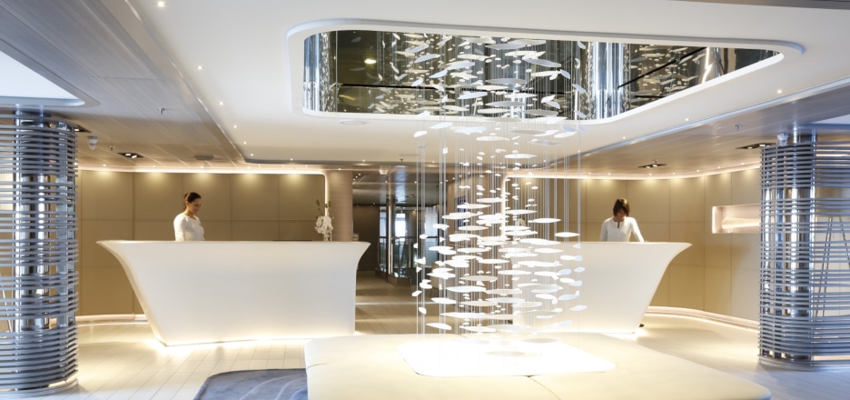
Excursion Reception and Office
On board the sister ships (Le Boreal, L’Austral, Le Soléal and Le Lyrial) and PONANT EXPLORERS, the reception desk and the excursion desk are arranged side by side to facilitate all your requests.
Reception: our receptionists can accommodate you 24 hours a day on all our ships (from 7 a.m. to 11 p.m. on Le Ponant) to answer all your needs, such as room service, etc.
The excursion office: the excursion team is available at all times to tell you about the onshore programmes, organise group or private excursions and to manage transfers at the start or end of the cruise.
On Le Ponant, the receptionist will answer all your questions about excursions.
PONANT Studio
A photography and videography team escort you throughout your trip. These professionals capture the most beautiful moments of your cruise, which you can share with family and friends upon your return. Meet them on DECK 5 (DECK 6 on the PONANT Explorers ships) at the photo/video area, where you can also order souvenir pictures and videos.
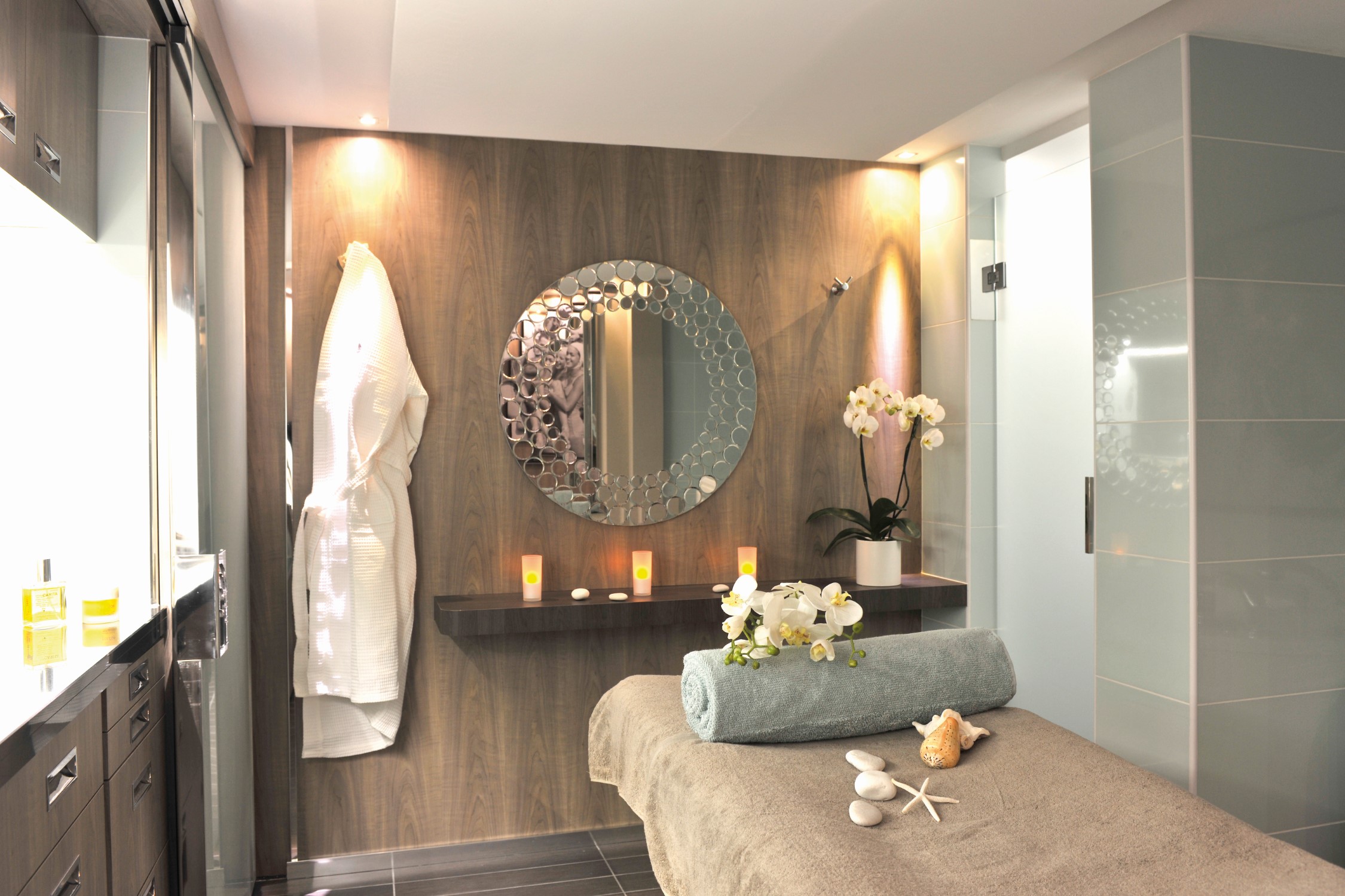
The Spa
All our ships feature an onboard spa. Equipped with massage cabins, a Turkish bath (Sisterships, Le Paul Gauguin), a sauna (Explorers, Le Commandant Charcot), or a Snow Room (Le Commandant Charcot), the spas offer a wide choice of top-of-the-range treatments provided in association with SOTHYS™, CLARINS (Le Bellot and Le Jacques-Cartier only), BIOLOGIQUE RECHERCHE (Le Commandant Charcot, Le Ponant) and ALGOTHERM (Le Paul Gauguin), leading French spa and wellness centre brands.
Discover a range of facial treatments, aromatic baths, exfoliation and body massage treatments designed to provide moments of complete relaxation. You can also supplement your beauty ritual with additional services such as hair-removal, makeovers, manicures and pedicures.
Prices and details of services in the PONANT Yacht Spa menu.

The Gym
The gyms on our ships are equipped with the very latest equipment and machines. Treadmills, exercise bikes, strength training machines and many other types of equipment are all provided in a laid-back relaxing environment. The wide floor-to-ceiling windows looking out over the sea add undeniable charm to the exercise sessions.
Each day also begins with organised morning workout sessions, either out in the open air or in the theatre. These are supplemented by water aerobics in the pool, or in the sea off the beach for PONANT passengers, when the situation allows it.
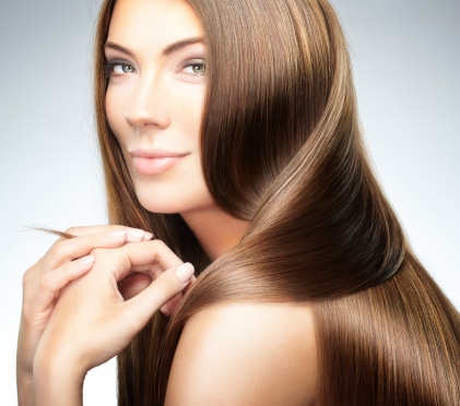
The Hairdressing Salon
Provided in partnership with KÉRASTASE®, L’ORÉAL PROFESSIONNEL® or DAVINES®, our hairdressing salons offer a complete range of top quality treatments designed to strengthen, nourish and reinvigorate hair’s shine and brilliance. Our stylists are available to serve all your styling, highlighting, colouring, cutting and tailored hair advice needs.
Laundry
Your stateroom Officer will be able to take care of your laundry**. The washing and ironing of your clothes will take between 24 and 48 hours. Only ironing** can be delivered on the same day. As dry-cleaning is not possible on the ship, please only give us clothes that can be washed in water.
** These services are not free of charge and are billed directly to your stateroom account.
Smoking Policy
PONANT EXPLORATIONS ships are non-smoking, even on the stateroom balconies. Smoking is only allowed in the exterior parts of the ship designated for the purpose.
Power Adapters
Adapters are provided on board, they are available at the reception office of our ships.
European Standard Sockets
The 220 volt 50 hertz alternating current is distributed by sockets meeting European standards. Onboard power is 200 volt AC (European standard) and 110 volt AC (North American standard). For safety reasons, hair irons and clothes irons cannot be used in staterooms. Please note that on Le Ponant, 110 volt AC is only available in stateroom bathrooms.
Age Restrictions
Children under one year of age shall not be authorised to embark on the ships.
For children aged between 1 and 8 years old, an authorisation to board the ship must be made in writing to PONANT EXPLORATIONS. Subject to agreement, a liability waiver must be completed and returned to the company to validate the registration.
On classic cruises (“yachting”), children are accepted from the age of one, with a maximum of 5 children between 1 and 6 years old on board.
On “expedition” cruises children are accepted from 6 years old (except cruises aboard Le Commandant Charcot) and must be fully independent during all the outside activities organised and during disembarkation in rubber boats, be sufficiently tall to sit on the inflatable sides of the boats, and old enough to understand, and immediately respond to the orders given by the persons in charge. As a result, children’s participation in any activity in an inflatable boat shall be subject to the agreement of the Captain and of the Expedition Head, depending on the sea conditions, and the difficulty of disembarking at each location visited. The ships do not carry Parka’s in children’s sizes. Parents must arrange to bring a suitable Parka for children. In all cases, children and young people under the age of 18 are at all times on board or on land under the full and total responsibility of their parents or carers.
Children aged 4 years or more can be welcomed in the Kid’s Club when the service is offered on board
Languages
The crew are bilingual in French and English. All signage and announcements made are in French and English. On certain cruises, crew members also speak other languages.
Telephone
A satellite telephone system is at your disposal for contacting anyone, anywhere in the world. The cost of the call is added to the stateroom account (€6/minute). Calls that you receive can be transferred directly to your stateroom or to any other communal area on the ship. To receive or send faxes, please see Reception.
Wi-Fi
Free Wi-Fi internet access is available on all of our ships, in both the staterooms and the communal areas. One or several computers are at your disposal in the recreation centres. Please note that the Wi-Fi connection may be discontinued depending on the navigation area and landscapes that may block the vessel from satellite coverage, especially at high latitudes (no connection possible beyond 80° North or South), or for technical reasons beyond our control.
Medical Facilities
There is a doctor on board available to the passengers on all our ships:
- The schedules of consultation are listed each day in the log book (emergency consultation 24/7).
- The Sisterships, PONANT EXPLORATIONS Explorers and Le Commandant Charcot also have a hospital for any small surgery.
- During the excursions, the passengers are accompanied by a doctor or a nurse.
- There is a fee for consultations on board . The price may vary according to the time and place of the consultation (hospital or staterooms). You must also pay for medications.
- The doctor on board is not authorised to distribute sick leaves and prescriptions. Only accounts and invoices are provided which may be used by the passenger to obtain a refund from his/her health insurance if his/her contract allows.
Medical Consultations
There is a charge for medical consultations undertaken by the doctor or nurse on board. The price can vary according to the time and place of the consultation (hospital or stateroom). Any medication must also be paid for by the passenger. If using medications on a regular basis make sure to bring adequate supplies for the duration of your cruise.
Special Medical Treatment
If you have any special treatment, we ask you to inform the reservation service when you register for the cruise, to note it on the information sheet before departure, then inform the on-board crew at the moment of departure and always keep your medication with you for the duration of the cruise.
Seasickness
Our ships (except Le Ponant) have stabilisers equipped with dynamic fins which adapt to the movements of the ship. This system allows the ship to anticipate and compensate for the pitching and tossing of the sea to achieve greater stability. Passengers suffering from seasickness will see their symptoms alleviated and are pleasantly surprised to not feel uncomfortable during their journey. However it is wise to bring travel motion medication with you for peace of mind.
Packing Tips
Technical Accessories
We advise you to equip yourself with a ski mask, sunglasses, walking poles (available to purchase in the shop), a waterproof rucksack, binoculars, a technical watch, a mosquito head net (for the Arctic) and a waterproof pouch.
Dress Code
Dress Code
We recommend wearing elegant, casual clothes at your discretion, and for the gala evenings, a cocktail dress for ladies and a shirt and tie for gentlemen, and a white or black-and-white outfit for the Officers’ evening. Shorts/Bermudas are not permitted in the evening in the gastronomic restaurants.
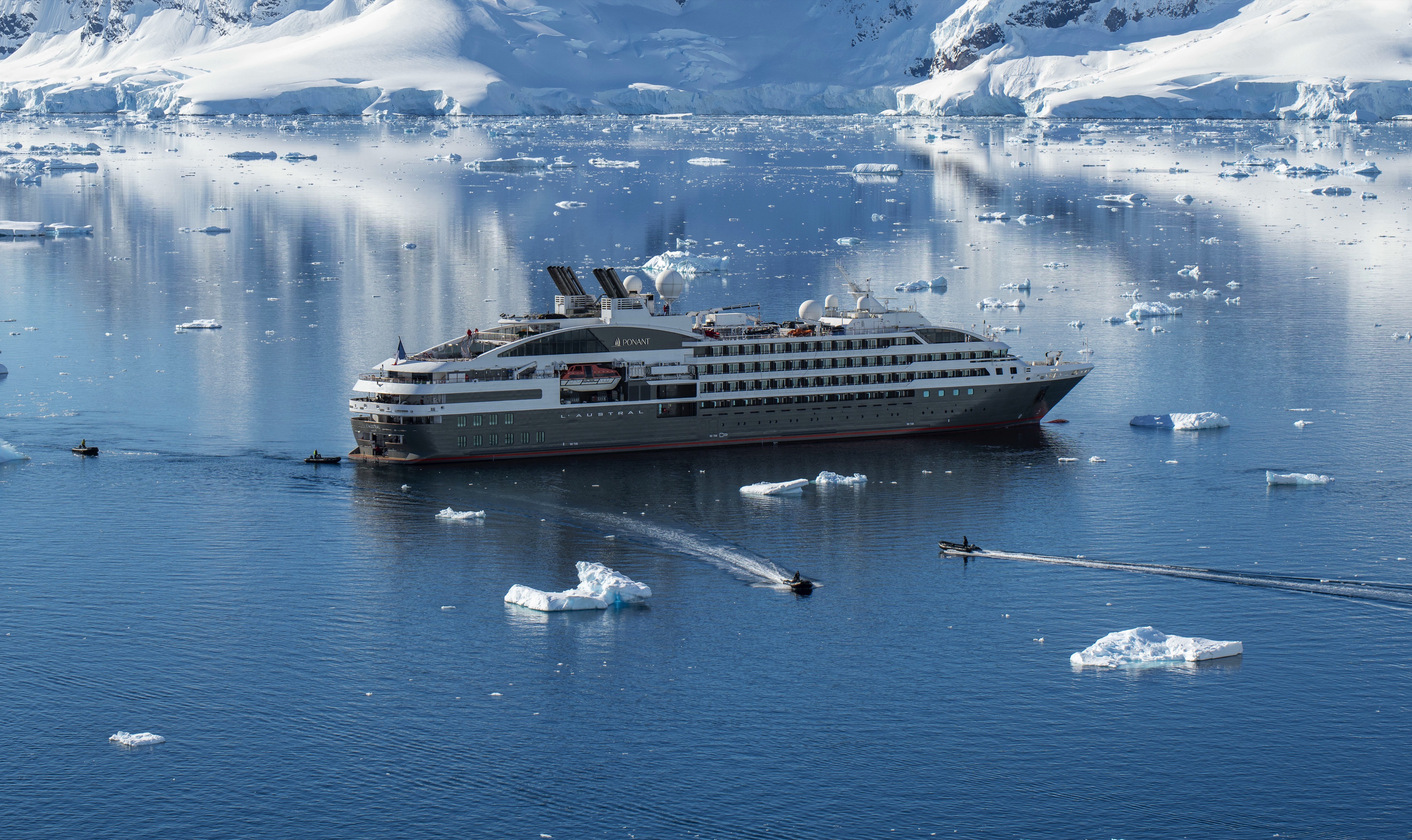
Expedition Cruise
On an expedition cruise, be sure to bring practical clothes as well as comfortable shoes suitable for travelling in Zodiacs and disembarking on beaches or mud flats. On tropical expeditions be sure to bring a hat, sunglasses and long sleeved/legged clothing. For polar cruises, you will be given a polar parka in your size and suitable boots will be available for use when ashore.
Sustainable Development
Sustainable development is enshrined in the company’s articles of association and has been at the heart of the PONANT EXPLORATIONS project since its inception. Founded over thirty years ago by committed sailors, the company was born out of a desire to share a passion for the oceans and the treasures of the Earth. This responsibility commits us to a respectful dialogue with the environment and the populations we meet and to investing in many fields related to the preservation and development of the natural and cultural heritage of the polar and oceanic regions.
Clean Ships
We were among the first cruise operators in the world to abandon the use of heavy fuels, and our ships are equipped with electric diesel engines and SCR catalytic converters, which enable a reduction in fuel consumption and emissions. Our polar exploration ship, Le Commandant Charcot, is a hybrid-electric vessel, propelled by liquefied natural gas (LNG). LNG enables a 25% reduction in carbon emissions, an 85% reduction in nitrogen oxide emissions and a 95% reduction in fine particle emissions. Each time we design a new ship, we equip it with the latest available eco-technologies, enabling us to maintain our position as the cruise industry’s environmental leader, ahead of international regulations in some areas. A commitment recognised by many independent organisations:
- Our entire fleet is Clean Ship certified by the Bureau Veritas. This certification guarantees that our ships fulfil very precise criteria: emissions levels, waste processing, waste water etc.
- In 2020, PONANT EXPLORATIONS was recognised as “the cruise operator with the greenest fleet in the world in terms of airborne emissions” by the German NGO, NABU.
- PONANT EXPLORATIONS was awarded the Prix des Palmes du Tourisme Durable 2020 (Prize for Sustainable Tourism) in the “Voyage” category for the elimination of heavy fuel oil in favour of LS MGO.
- In 2019, PONANT EXPLORATIONS became the first European cruise company to obtain the North American Green Alliance certificate. This certifies that its members have adopted practices and technologies that are respectful towards the environment.
- PONANT EXPLORATIONS is also a signatory of the Charte Bleue from Armateurs de France, which commits the maritime sector to act to protect the marine environment.
Wastewater
All of the wastewater is treated by means of processes that exclude the use of chemical products. The recycled water is used to clean the exterior of the ship. The water that is discharged into the sea is treated, drinkable water.
Waste
We have optimised our organisation in order to reduce waste at the source. Waste is nonetheless still produced on board. As of 2020, 60% of this is sorted and recycled, with an objective of 85% set for 2023. We ensure the complete traceability of this waste.
Single-use plastics
We have eliminated the use of single-use plastics (straws, cups, food serving trays, laundry bags etc.). A metallic flask is issued to each passenger on expedition cruises and water fountains are available in the common areas of the ships. We are also developing the bottling of our water in glass bottles.
Special Diets
And so that everyone’s tastes are catered to, special menus are available on request for guests with specific dietary requirements (low-fat, vegetarian, gluten-free, etc).
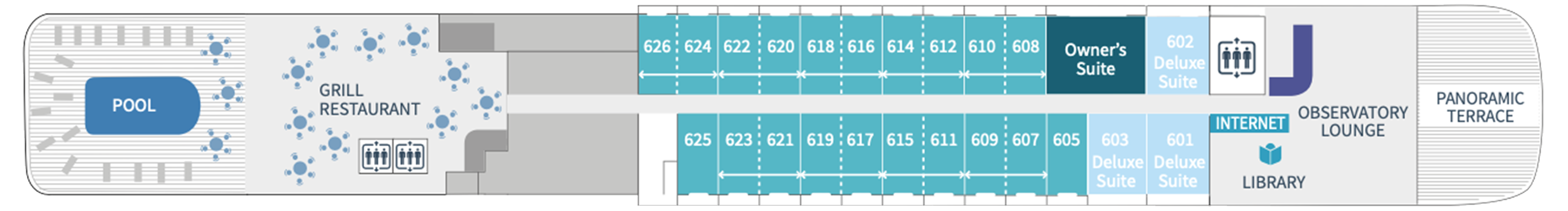
Deck 6
- Pool
- Grill Restaurant
- Internet Café and Library
- Observation Lounge
- Panoramic Terrace
- Owner’s Suite
- Deluxe Suites
- Prestige Staterooms
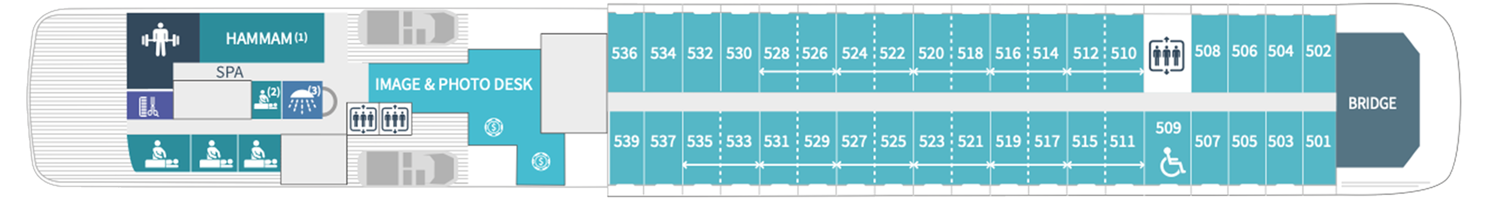
Deck 5
- Fitness Room
- Spa
- Hair Salon
- Image and Photo Desk
- Bridge
- Hammam
- Prestige Suites
- Prestige Staterooms
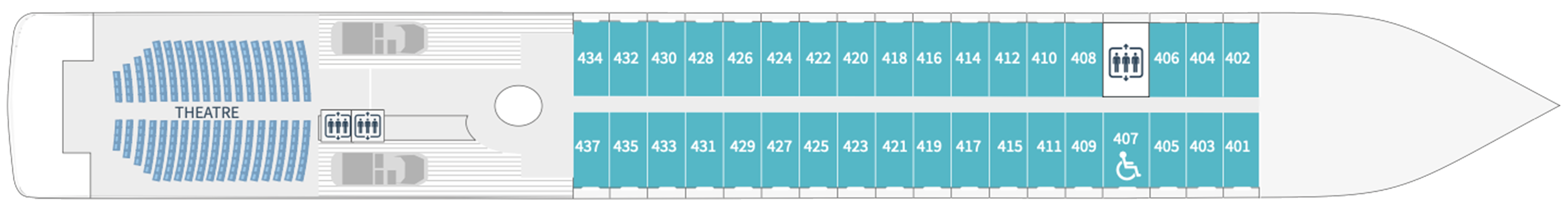
Deck 4
- Theatre
- Prestige Staterooms
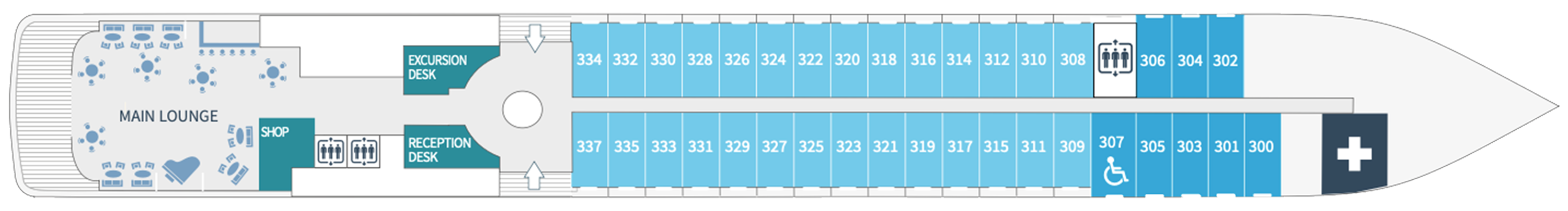
Deck 3
- Main Lounge
- Shop
- Excursion Desk
- Reception Desk
- Medical Centre
- Deluxe Staterooms
- Superior Staterooms
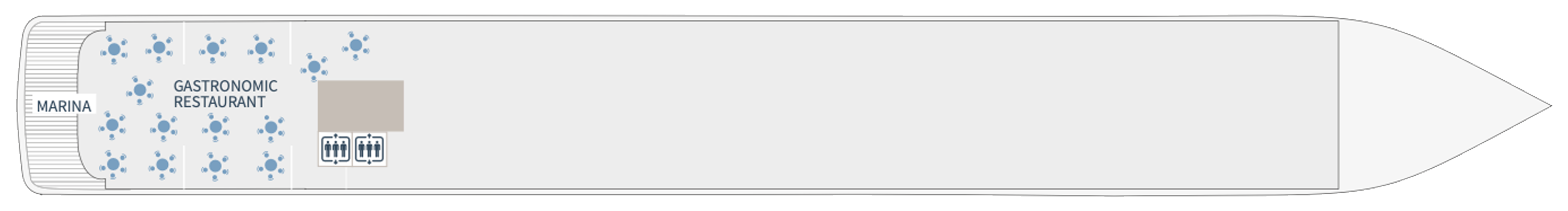
Deck 2
- Gastronomic Restaurant
- Marina